| TWL Water Level Forecasts Forecasts for Bay and River Gauges - Numbers in Parentheses Denote Minor, Moderate, Severe Flood Levels |
|
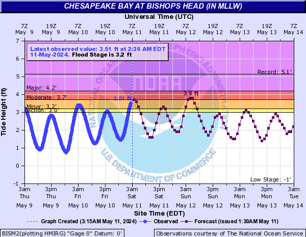
| Cambridge MD (3.5', 4.0', 4.5') | Bishops Head MD (3.25', 3.75', 4.25') |
 |
 |
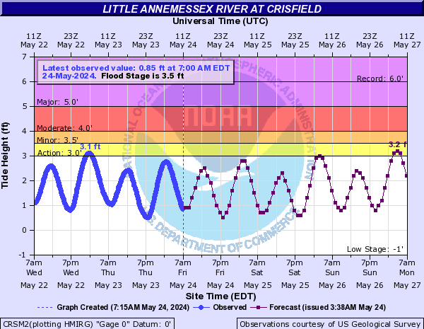
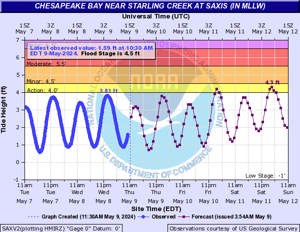
| Crisfield, MD (3.5', 4.0', 5.0') | Saxis VA (4.5', 5.0', 6.0') |
 |
 |
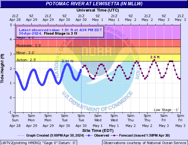
| Dahlgren VA (3.5', 5.0', 6.0') | Lewisetta VA (3.0', 3.5', 4.0') |
 |
 |
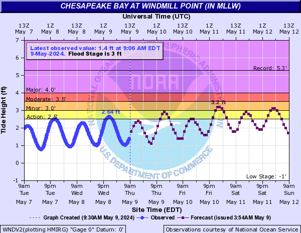
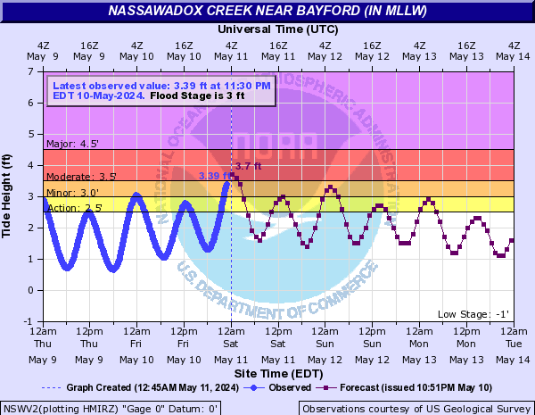
| Windmill Point VA (3.0', 3.5', 4.0') | Bayford VA (3.0', 3.5', 4.5') |
 |
 |
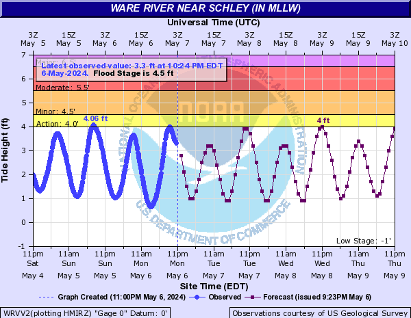
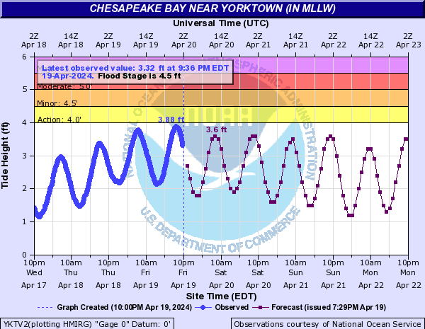
| Ware River Near Schley, VA (4.5', 5.5', 6.5') | Yorktown USCG VA (4.5', 5.0', 5.5') |
 |
 |
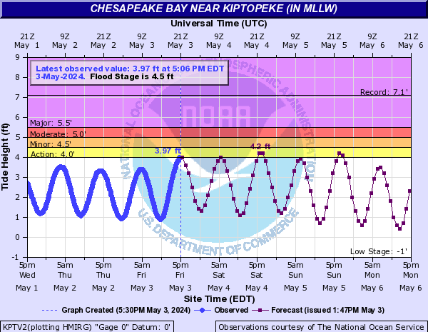
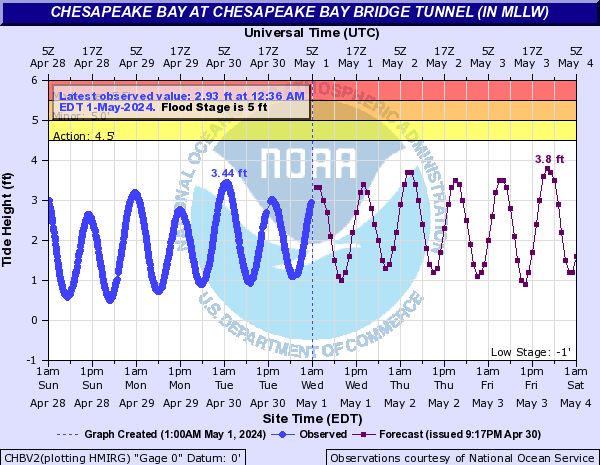
| Kiptopeke VA (4.5', 5.0', 5.5') | Chesapeake Bay Bridge Tunnel VA (5.0', 5.5', 6.0') |
 |
 |
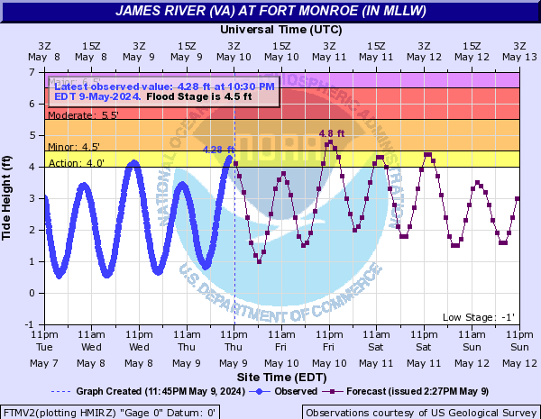
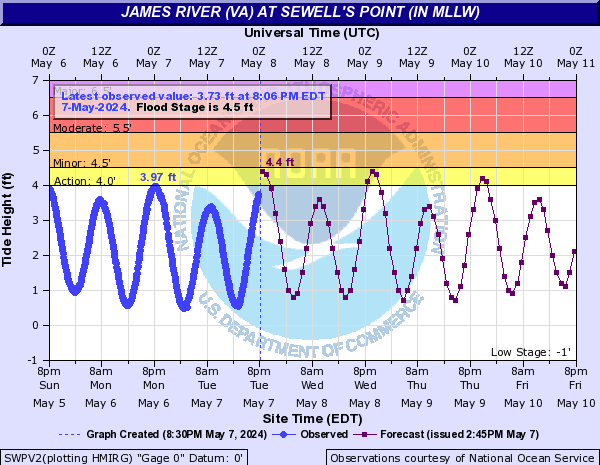
| Fort Monroe VA (4.5', 5.0', 5.5') | Sewells Point VA (4.5', 5.5', 6.5') |
 |
 |
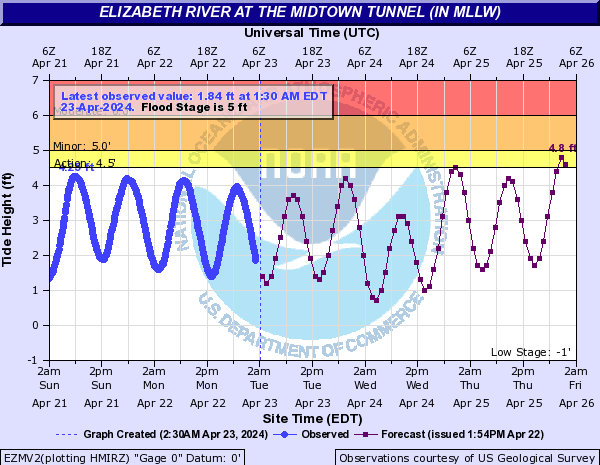
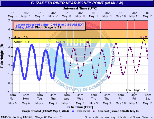
| Midtown Tunnel (4.0', 4.5', 5.0') | Money Point VA (5.0', 6.0', 7.0') |
 |
 |
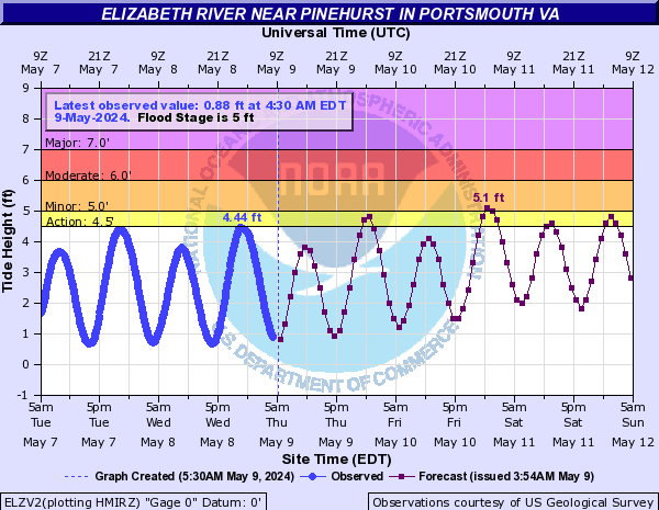
| Portsmouth VA (4.0', 4.5', 5.0') | Jamestown VA (5.0', 6.0', 7.0') |
 |
 |
| Forecasts for Ocean/Coastal Gauges - Numbers in Parentheses Denote Minor, Moderate, Severe Flood Levels | |
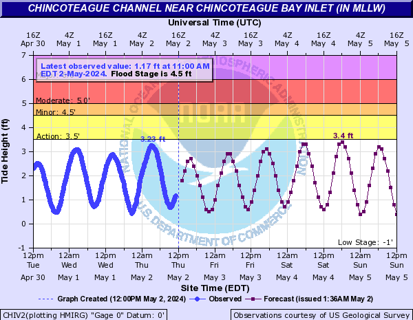
| Ocean City MD (4.0', 5.0', 6.0') | Chincoteague VA (4.5', 5.0', 6.0') |
 |
 |
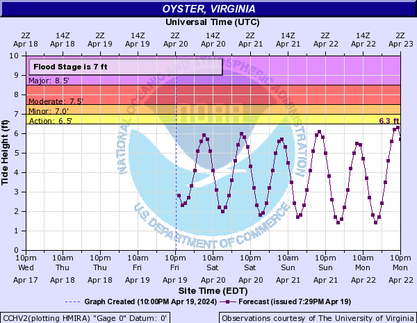
| Wachapreague VA (6.5', 7.5', 8.0') | Oyster VA (7.0', 7.5', 8.5') |
 |
 |
| Duck, NC (5.5', 6.0', 6.5') | Chowan River (Waterfront Park), NC (2.0', 3.0', 4.0') |
 |
 |
|
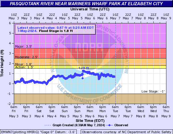
Pasquotank River (Elizabeth City), NC (1.8', 2.5', 3.5')
|
|
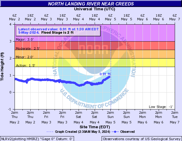
| Back Bay VA (1.8', 2.3', 2.5') | Southside VA Beach VA near Creeds (2.0', 2.5', 3.0') |
 |
 |


 Coastal Flood
 Heat
Heat