• General
• General
Satelytics measures every pixel every time. Vegetation analysis, methane measurement, water quality analysis, change detection — all can be obtained in parallel for your entire asset area. I like to think of this coverage like casting a net instead of fishing with a single line. The former sweeps a wide area, catching whatever is in its path, while the latter is confined to a limited space and targets one specific species. Let me explain.
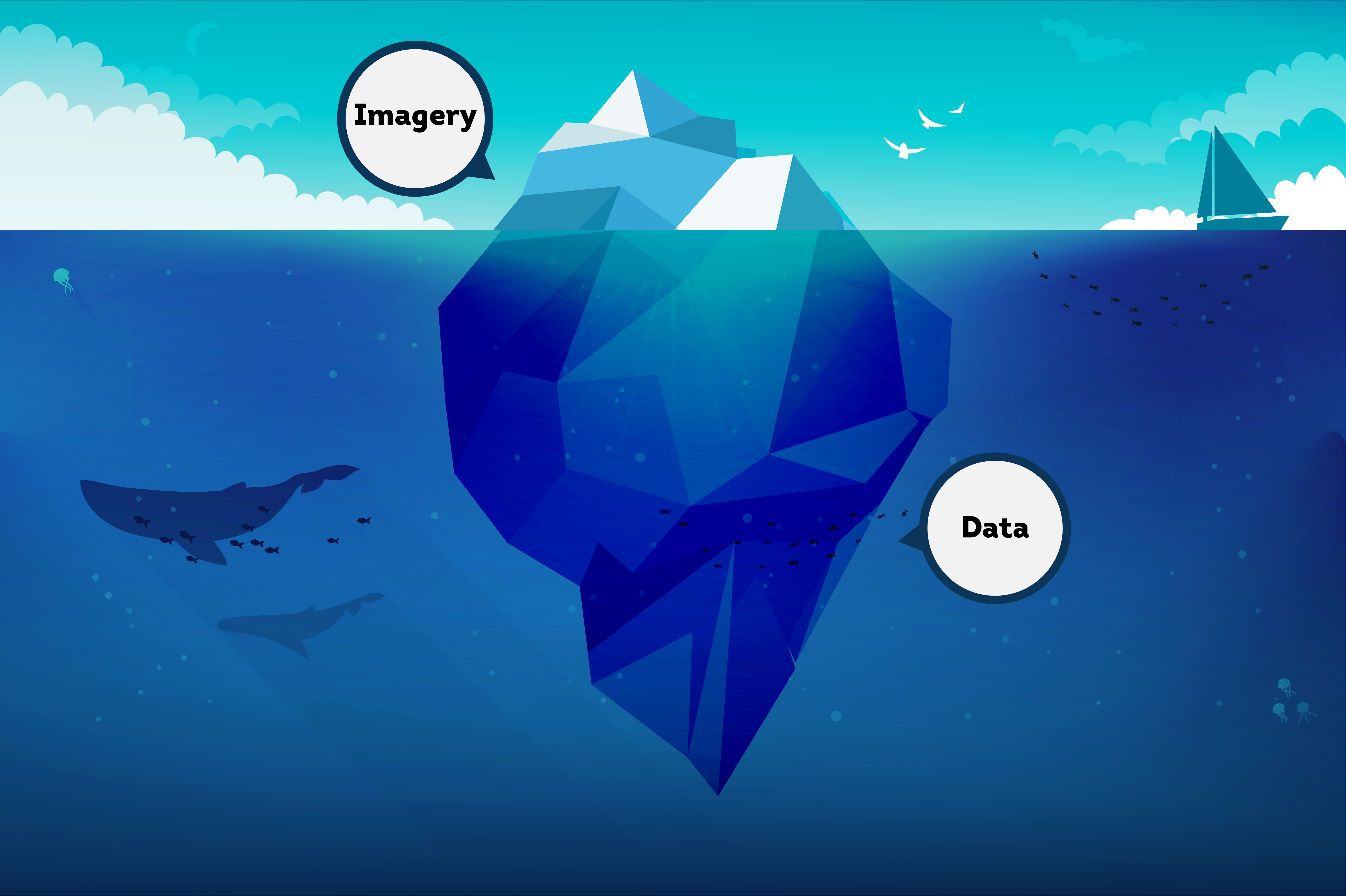
Data vs. Imagery. When asked what I do for a living, I say I am in software sales for Satelytics, a company providing monitoring solutions. Continuing the conversation, I dig deeper into Satelytics’ solution, describing the data that commercial satellites provide. The imagery is interesting to look at, but the underlying spectral data is like the iceberg analogy where 90% of the mass and size is below the water’s surface.
Spectral data is the detection and quantification of the sun’s light reflected off the earth’s surface. Led by experts in geospatial analytics, Satelytics’ science professionals build algorithms that identify unique spectral signatures and their intensity. Physical, chemical, and biological phenomena/species on land, water, and in the air can be detected. All of this put together means that Satelytics quantifies to a very high degree of accuracy. Many customers aren’t even aware is a possibility when we first approach them!
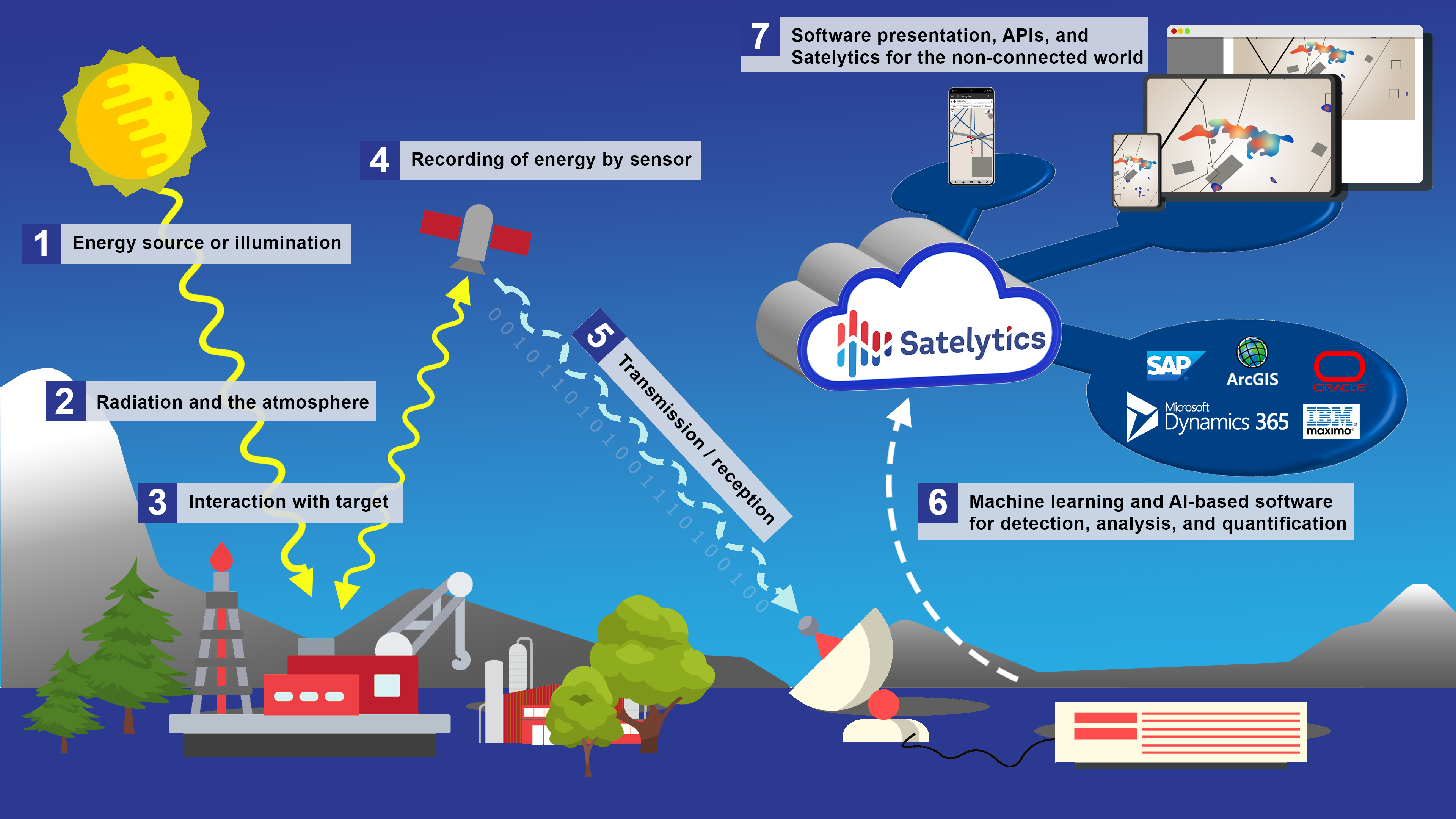
Satelytics: How It Works
Leave No Stone Unturned. Satellite monitoring provides access to every corner of an area of interest without intrusion. Select satellite vendors supply high-resolution data for an area tasked by Satelytics. The minimum area that can be surveyed is 100 km2, with no maximum. Every square meter inside the area of interest is surveyed by Satelytics’ algorithms. Above ground infrastructure, leaks, change detection, state of construction, and more can all be monitored simultaneously.
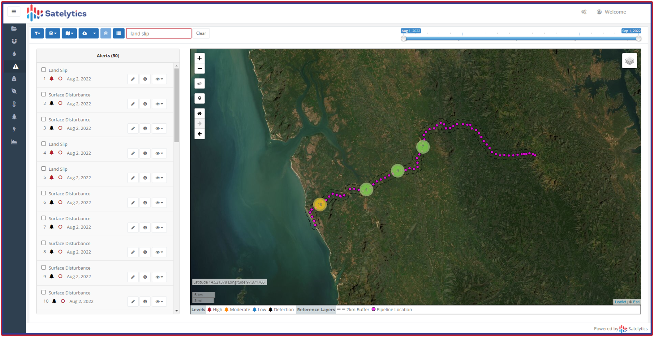
Sleep easy at night with Constant Vigilance™ over your entire infrastructure
Satelytics’ alerts benefit multiple user groups within our customers’ operating areas, casting a net over your entire infrastructure. With Constant VigilanceTM, you can sleep easy at night, knowing changes will not go undetected.
We use cookies to analyze our web traffic and to enhance your experience. By continuing to view this website, you agree to our use of cookies.
Our Privacy Policy