• General
• General
What’s in a name? For Satelytics the name says it all. Satelytics provides rapid, actionable alerts to threats and challenges across vast asset. While our name rightfully suggests our primary data source comes from high-resolution satellite imagery, we process data from many different sources. Another pillar of Satelytics is that we are data agnostic.
What's in a name? That which we call a rose by any other name would smell as sweet.
William Shakespeare
As with our name, being data agnostic was a strategic choice. We are always pushing to provide more solutions, with results returned on ever-decreasing timelines, for our customers. We never want to be tied to a single satellite, type of sensor, or hardware platform. Here is an overview of the sensors and hardware platforms we use.
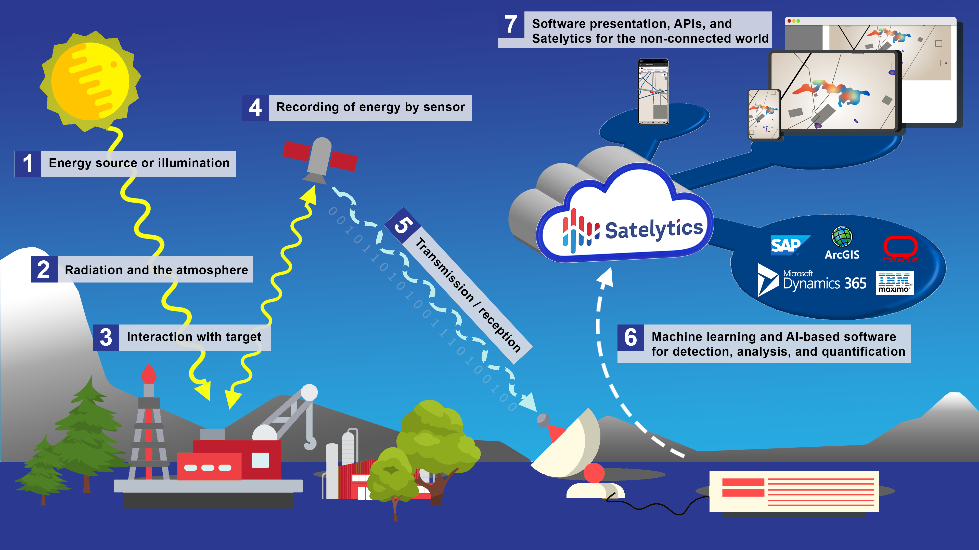
Passive Sensors rely on the sun reflecting off the earth’s surface back to the sensor. Satelytics’ Constant Vigilance™ algorithms analyze raw imagery, focusing on specific bands of the electromagnetic spectrum. Most people think of earth observation satellites as supplying a picture from space, but the underlying data packets contain many wavelength bands which can be analyzed to provide detection and often quantification. Imagery obtained from airplanes, UAVs, and cameras is all processed by Satelytics similarly.
Active Sensors emit radar or laser energy and then measure what’s reflected off the earth’s surface. Satelytics uses active sensor data, including synthetic aperture radar (SAR), to determine digital elevation models for vegetation and geohazard projects.
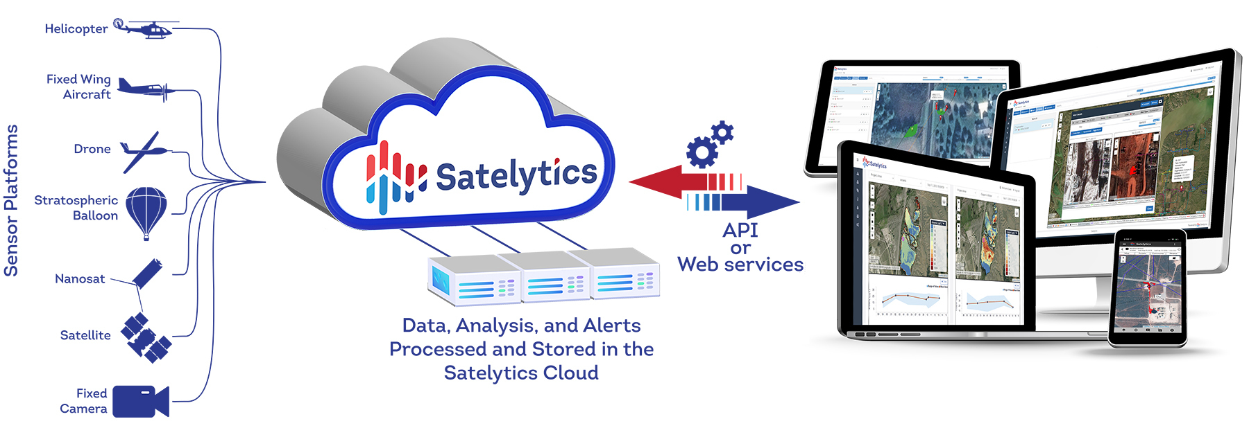
Hardware Platforms include commercial and government-owned satellites, sensors mounted on aircraft or UAVs, and fixed cameras. Satelytics has proven data fusion with sensors mounted on all of these platforms.
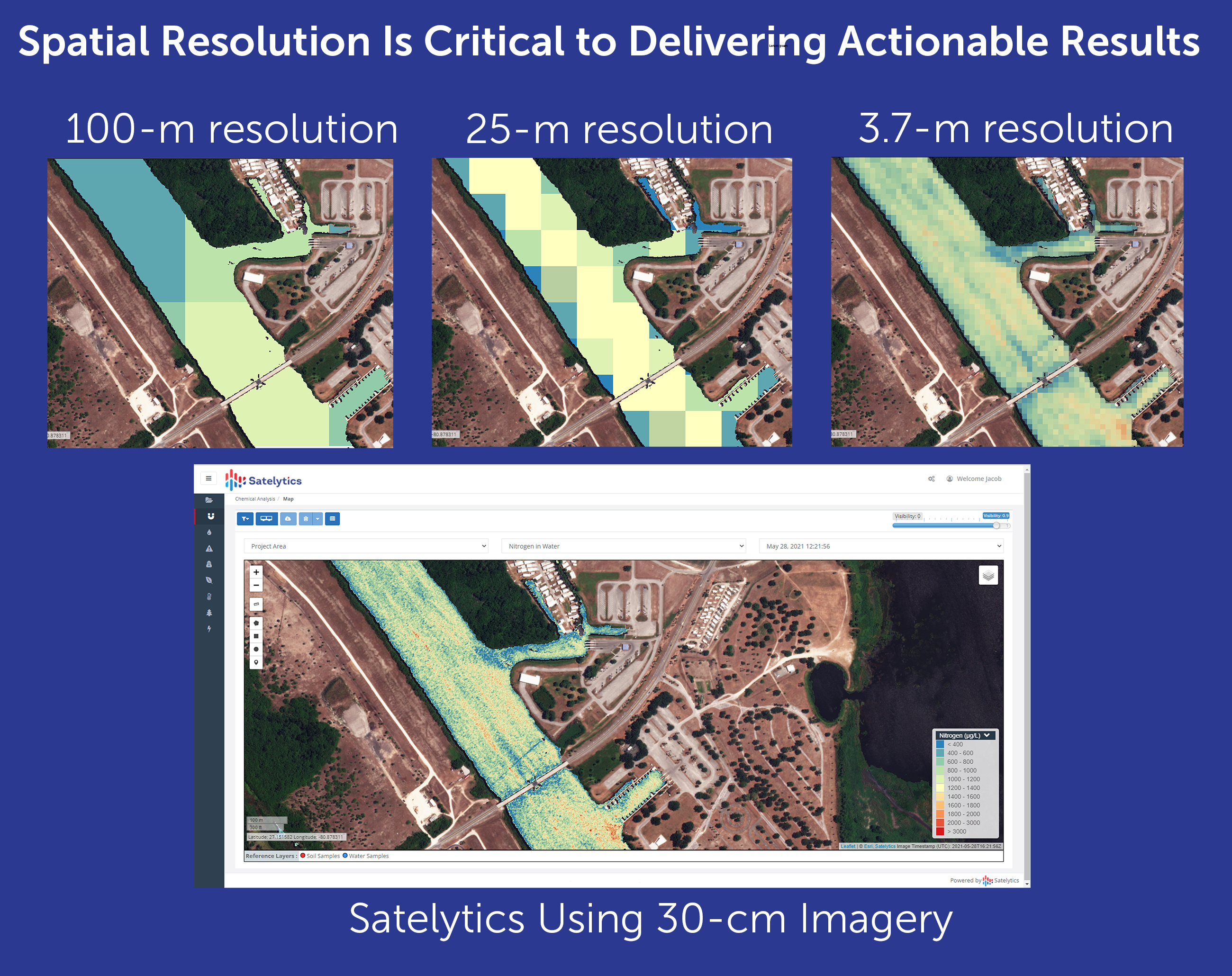
The sensors that collect the data we use come primarily from commercial vendors, which typically provide higher spatial resolution. Detection of objects is only as good as the resolution provided by the sensor. Many of our customers find Satelytics only after dabbling unsuccessfully with monitoring that uses free low-resolution imagery. The old adage holds true: you get what you pay for. Poorer quality imagery cannot see and measure what we can, leaving users frustrated and without solutions.
“You are so far ahead of the competition,” a customer recently told me. And that’s where we plan to stay. Satelytics lives on the leading edge, processing the best imagery from the best sources — always running to provide the best solution. Call us to explore what data source might suit your needs, then learn how Satelytics will analyze that data in multiple ways to solve multiple business challenges.
We use cookies to analyze our web traffic and to enhance your experience. By continuing to view this website, you agree to our use of cookies.
Our Privacy Policy