• General
• General
I’m always looking for article inspiration, and sometimes the spark comes from the simplest sources — like my two-year-old daughter. Yesterday was a get-going type of morning, meaning a lot of wiggling while trying to get her dressed. She sprang out of the room before I could get her pants on! I caught her in the hallway, reminding her she needed pants — a thought at which she just laughed.
Have you ever felt like that? Like you have so much going on that you forget what you need most?
Infrastructure managers are increasingly looking to geospatial analytics to direct field personnel, sending them only to locations needing their expertise. Enter Satelytics.
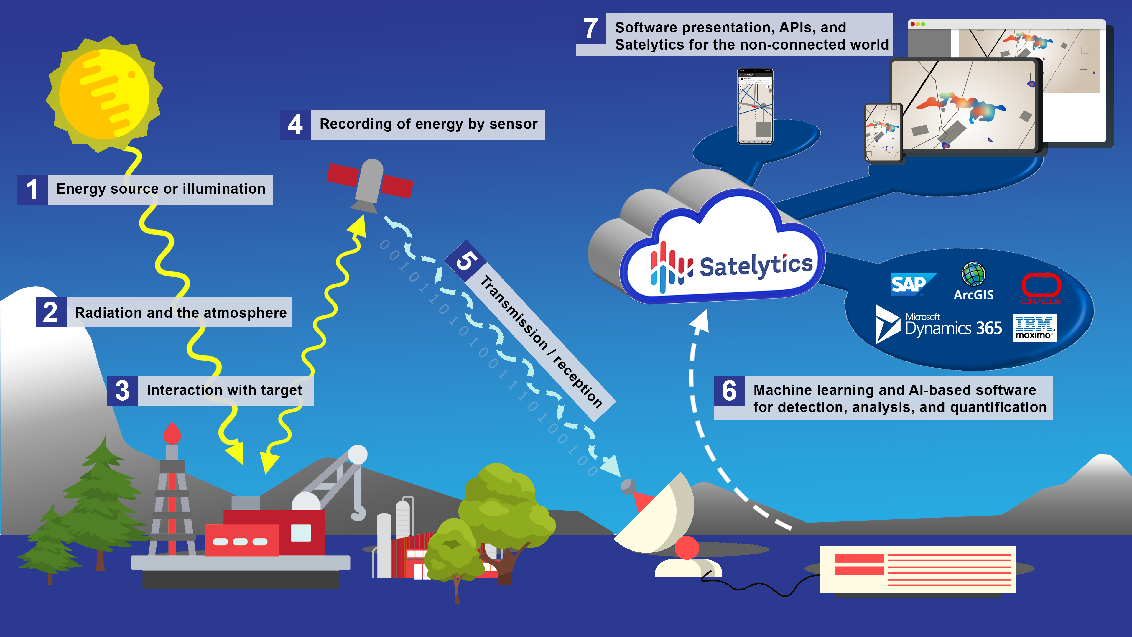
Satelytics is a cloud-based, web-hosted geospatial analytics software suite. There is nothing to install, so there are no threats to your internal network. We have 40+ algorithms that can be run simultaneously on a single satellite image. Satelytics is designed to offer accessible, accurate data, with alerts available a few hours after satellite overpass via smartphone, tablet, and desktop. Each alert from Satelytics includes exact coordinates.

Field teams can take Satelytics on the go, too. We created Satelytics for the Non-Connected World for remote areas where cell or internet coverage isn’t available. The app utilizes your phone's cache to take alerts into the field, input notes, and take pictures. When connectivity is restored, all updates are automatically uploaded to the cloud.
Use Satelytics anywhere and everywhere. Don’t get caught running out without accurate information!
We use cookies to analyze our web traffic and to enhance your experience. By continuing to view this website, you agree to our use of cookies.
Our Privacy Policy