• Pipeline
• Pipeline
I speak often in this forum about Satelytics algorithms and how all 40+ measurements can be obtained from a single set of data to maximize return on investment. This is the beauty of how Satelytics was designed. Today, however, I am going to focus on a single algorithm that was built by our science team to locate and address issues surrounding produced water.
Produced water, or brine, is a by-product of oil and gas production. For every barrel of oil produced, multiple barrels of high salt content water are produced and must be disposed of in deep geological formations. In my home state of North Dakota, saltwater disposal wells dot the landscape and are connected to production pads through gathering pipelines or with trucks transporting the salty liquid from storage tanks. From the time this brine hits the surface until it is sent back deep underground, risk exists in handling the fluid. Produced water can be much saltier than seawater and causes permanent damage to surrounding soils when it spills.
Satelytics developed our produced water algorithm on behalf of our oil and gas customers to detect the presence of brine on various land surfaces. Satelytics’ algorithm measures light reflectance in the infrared spectrum, focusing on specific chemicals commonly found in produced water. These chemicals cause produced water’s spectral reflectance signature to be different from that of pond water, or a rain puddle, or a hydrocarbon signature. We have even identified brine in areas where snowmelt is occurring, as shown below. The algorithm was field-tested by our scientists and customers in the Bakken in 2019 and has been in use for customers ever since.
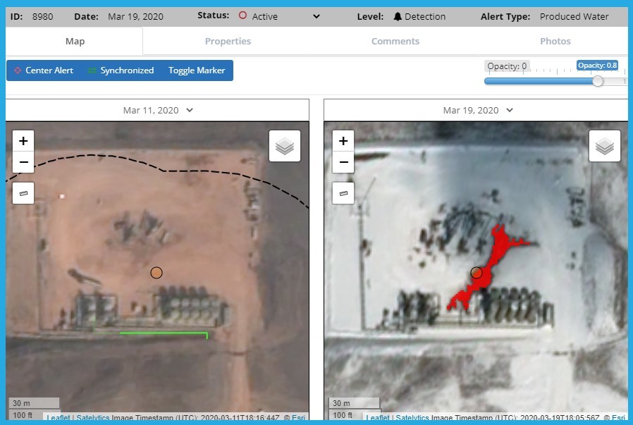
A confirmed produced water leak, identified amidst a snowy background.
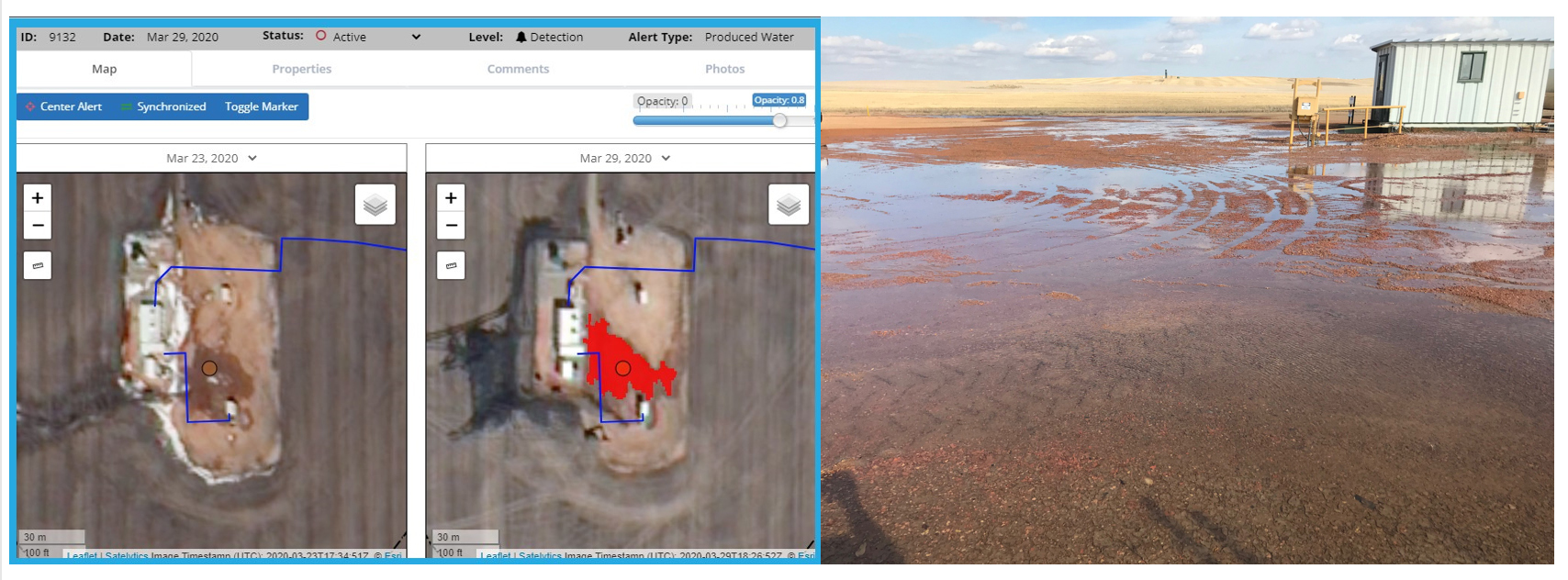
A confirmed produced water leak detected by Satelytics.
In addition to the location of a surface expression of brine, Satelytics looks for subsurface leaks using vegetation surrogates. Analysis of reflected infrared light does not permit the algorithms to “look” below the surface. What can be measured, however, is vegetation health. Vegetation is our “canary down the mine” and is incredibly sensitive to unhealthy soil conditions. When looking for produced water, we run our suite of vegetation algorithms in parallel to identify subsurface and surface spread of saline solutions.
Satelytics has alerted on some very small and some very large brine spills. With our AI platform, every pixel is analyzed every time with spatial resolution down to the square foot. Results are published to our web portal Satelytics.io which also includes a measuring tool for determining physical size of an incident. We can also monitor re-vegetation after remediation has occurred which is often tied to release of a financial bond.
Satelytics’ produced water algorithm — one of 40+ measurements helping you minimize risk and get out ahead of threats to infrastructure and environment.
We use cookies to analyze our web traffic and to enhance your experience. By continuing to view this website, you agree to our use of cookies.
Our Privacy Policy