• Power Utilities,Water & Wastewater
• Power Utilities,Water & Wastewater
Satelytics differentiates itself with our measurement capabilities. Our science professionals have taken infrared spectral science out of the chemistry lab and applied it to data coming from sensors on satellites, aircraft, drones, and fixed sensors. Quantification is key.
Satelytics provides bathymetry measurements for waterbodies to a depth of 40 feet. This measurement is often accompanied by our total suspended solids (mg/L) and turbidity (NTU) algorithms, which can map and quantify sources of sediment load and their spread.
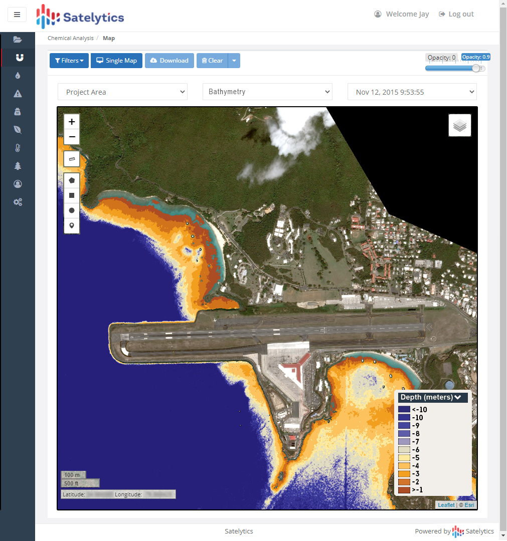
Bathymetry results
How are these algorithms being applied? Our bathymetry tool has been used to map the floors of rivers, lakes, estuaries, ocean bays, and more. This data can point to areas where dredging is needed and can be utilized to monitor sediment buildup near dams and canals. Contours can be updated regularly and easily with new satellite data analyzed by Satelytics algorithms.
Watershed managers use TSS and turbidity to track everything from wildfire ash loading into a reservoir to sediment sources from activities surrounding streams and rivers. Activities like population growth, agriculture, the draining of wetlands, and deforestation all affect water quality by introducing particulates into watersheds. The outputs from satellite monitoring can direct restoration efforts over vast land and water areas. We published an interview in 2020 with a customer at The Nature Conservancy who shared the value remote sensing can play in monitoring particulate loading and flow through a watershed area.
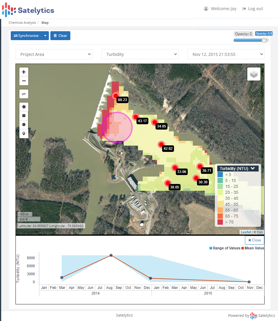
Measuring turbidity at a dam
We repeat this message often: wide-area coverage is something that can only be obtained economically from satellites. Satellites also provide rapid transfer of imagery to the cloud for processing so that results can be delivered a few hours after overpass. Some customers also use our TSS algorithm immediately after natural disasters — many of which can upset mechanisms for rivers and lakes.
Bathymetry, TSS, and turbidity are just a fraction of Satelytics’ offerings used to paint a picture of the health and mechanisms at play in watersheds of all sizes across the globe.
We use cookies to analyze our web traffic and to enhance your experience. By continuing to view this website, you agree to our use of cookies.
Our Privacy Policy