• General
• General
Prospective customers often ask, “Can you see below the earth’s surface?” The short answer is no. We can’t see below the Earth’s surface. But that doesn’t mean we can’t sense subsurface events and risks. While Satelytics’ passive data collection method is limited to surface detection and quantification, measurable surface attributes — or “surrogates” — may indicate events and risks below ground.
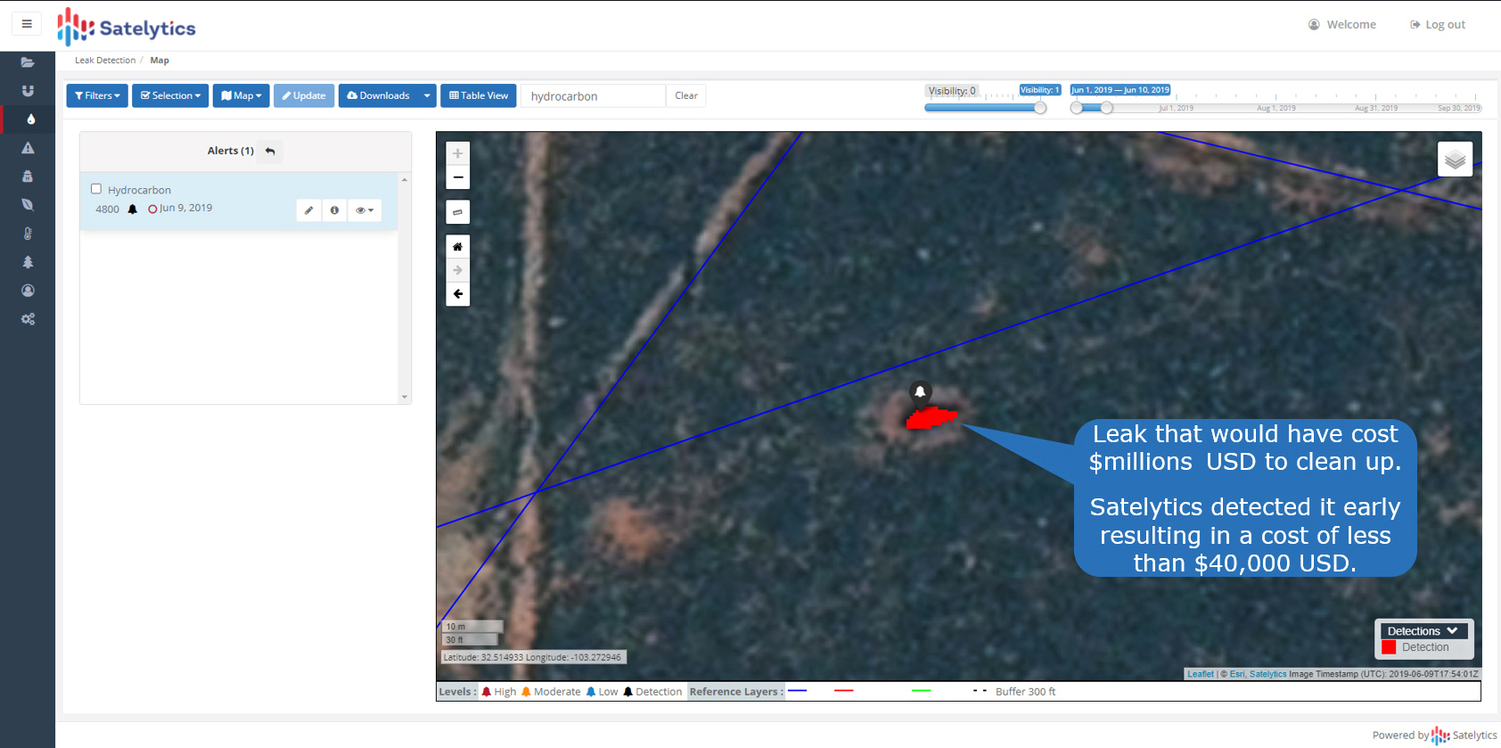
Vegetation. Vegetation health is a powerful surrogate. For example, a decline in vegetation health caused by chlorosis can point to soil or pesticide issues. Our upstream and midstream customers use vegetation health to alert them to underground pipeline leaks. Surrogates help us discover pinhole leaks that often go undetected by SCADA systems. As shown in the example below, it takes only a small amount of oil, liquid gas, or brine to cause vegetation stress.
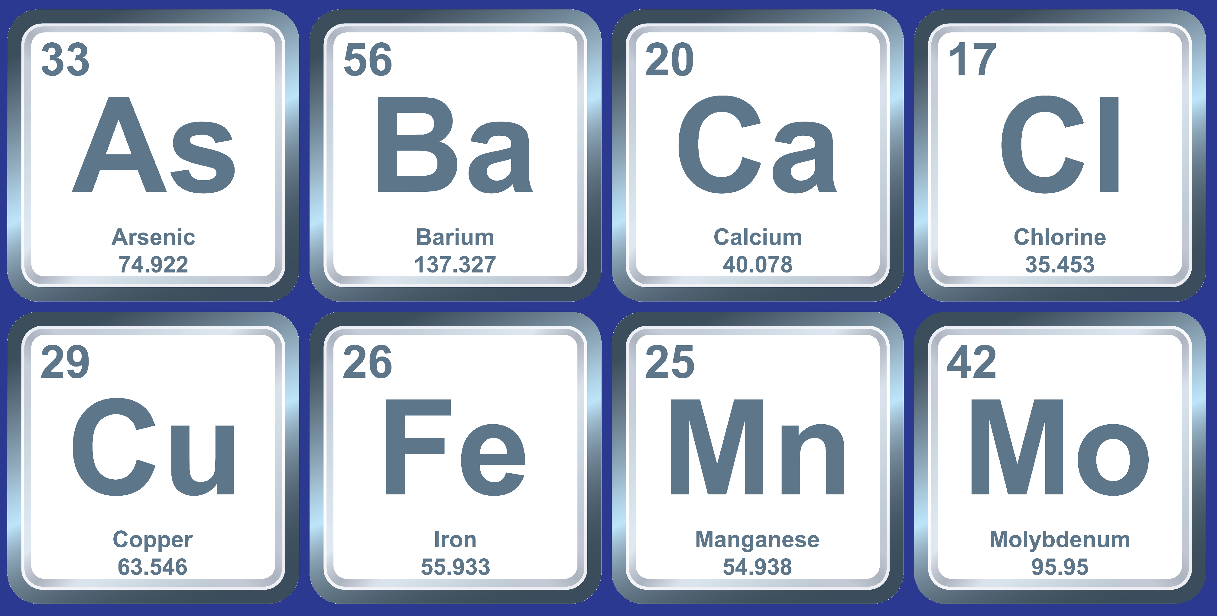
Metals. Satelytics quantifies specific metals, compounds, and other contaminants in parts-per-billion concentrations. These metals can be surrogates for other elements that might be present above or below grade. These capabilities over land can also be applied to water bodies.
Quantifiable metals and other surrogate contaminants include:
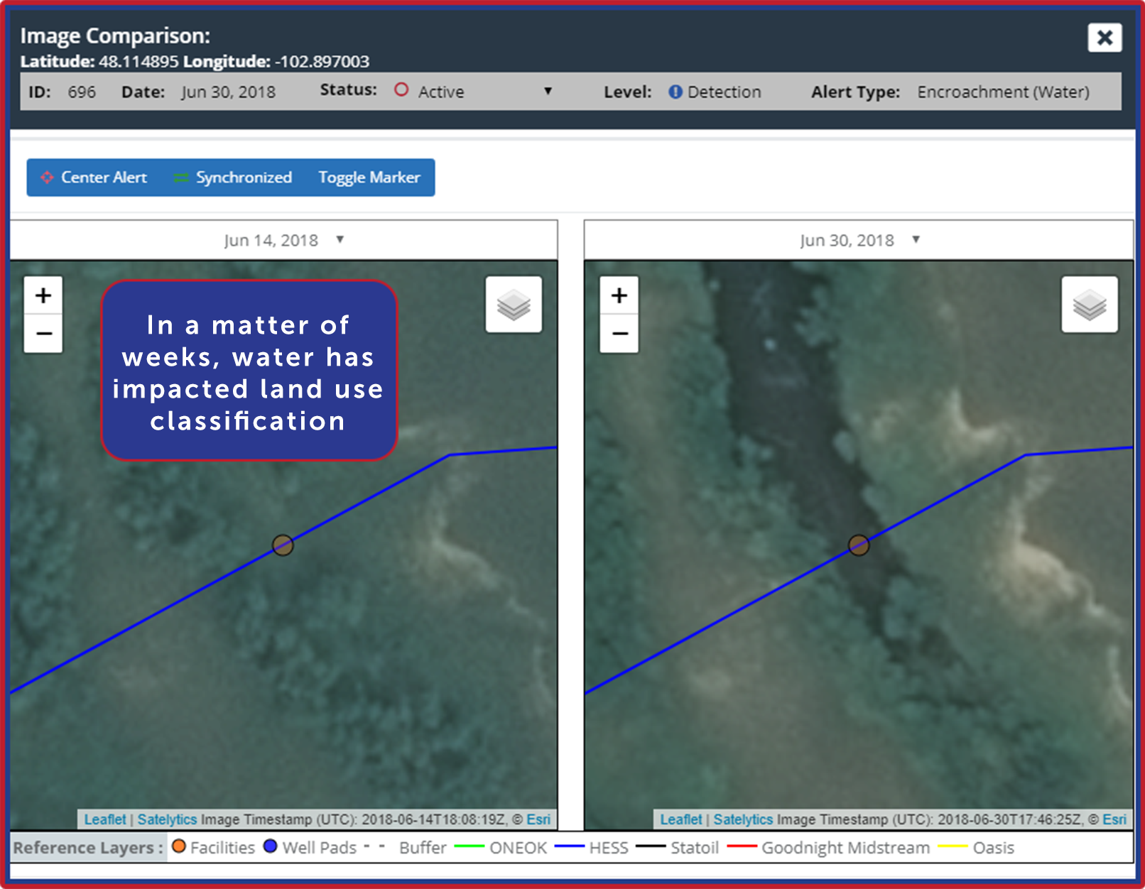
Surface Changes. Satelytics provides a digital terrain model where minute surface changes can alert integrity managers to land movement before it becomes a disaster. Alerts related to vertical and lateral land movements, loss of cover, and other encroachments are delivered a few hours after satellite overpass.
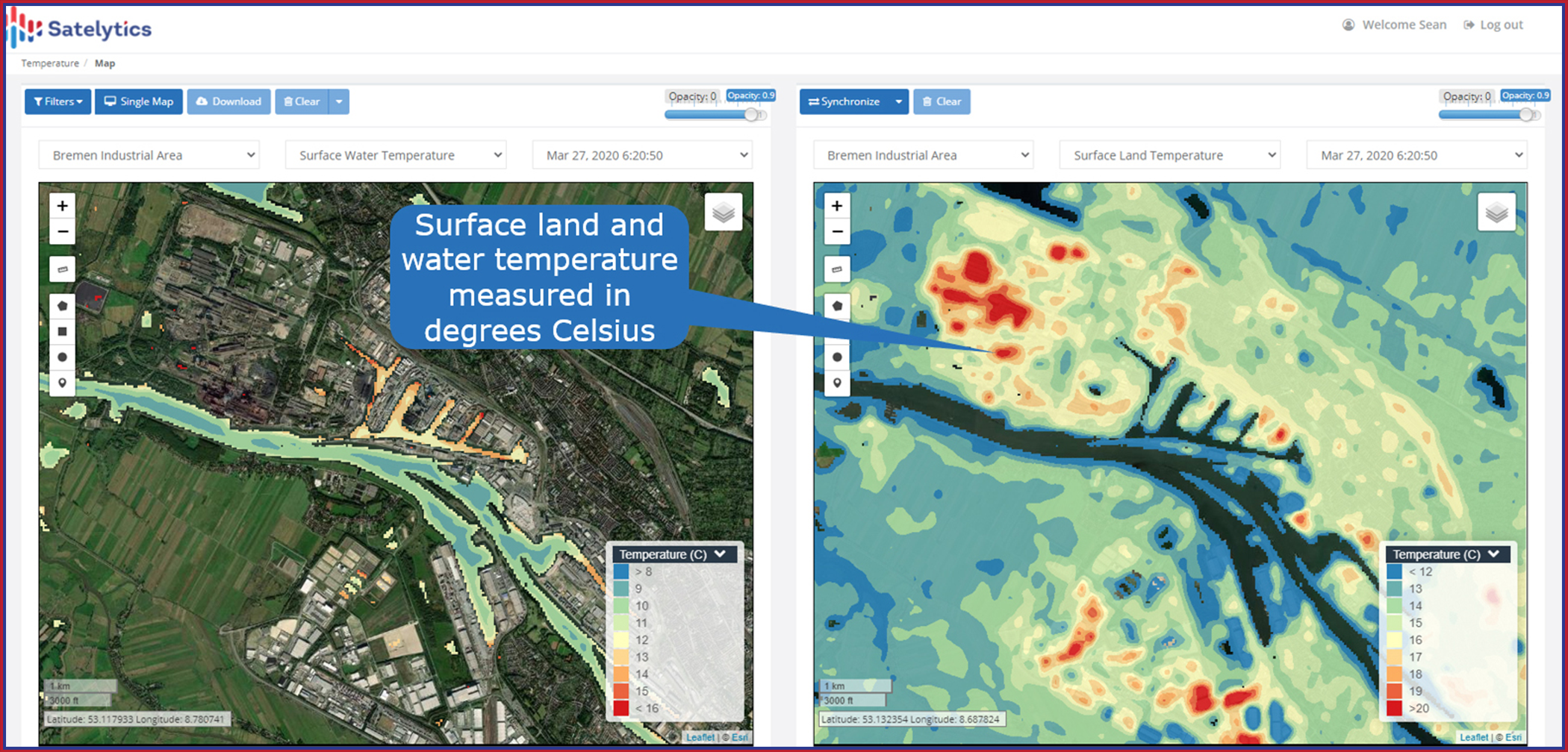
Surface Temperature. We can measure surface temperature on land and water with an accuracy of ±1°C. Warmer waters present ideal conditions for increases in cyanobacteria, for example.
Satelytics analyzes big data from multiple sources to provide timely, actionable alerts to managers of large asset areas. We share the examples above to open the mind to what is possible with geospatial analytics. The concept of surrogates and these examples have been developed for real customers to assist them with real-world challenges. Surrogates direct insight into subsurface conditions and systems — all without ever having to put a shovel in the ground.
We use cookies to analyze our web traffic and to enhance your experience. By continuing to view this website, you agree to our use of cookies.
Our Privacy Policy