• General
• General
In a world where people can claim to be anyone on the internet, where the lines between truth and opinion are constantly blurred, where expertise is given without accreditation, how do you separate fact from fiction? To flush out pretenders and false information, you have to start at the source. At the core of Satelytics is the science and technology of spectral signatures and geospatial analytics.
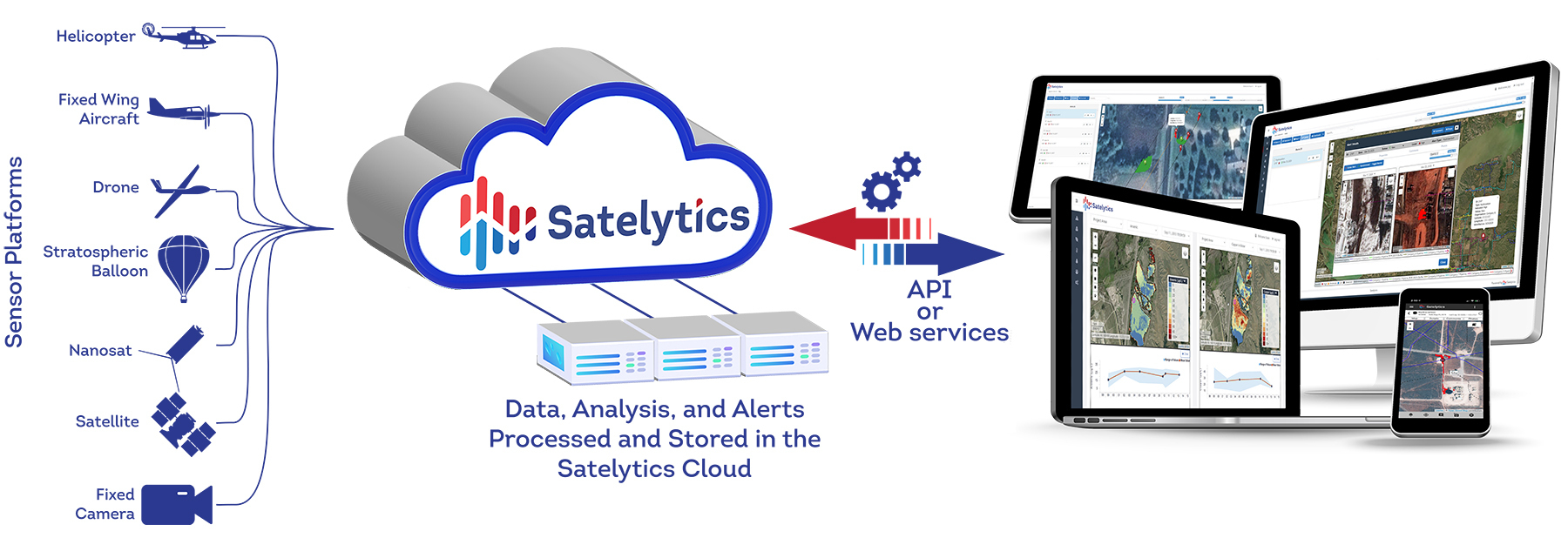
Satelytics analyzes multispectral and hyperspectral data from a variety of sources, including enterprise satellite data providers, conventional aerial platforms, drone platforms, stratospheric balloons, and fixed or persistent sensor platforms.
Visible light, infrared light, and other portions of the electromagnetic spectrum from the sun are reflected off objects and materials on Earth to an aerial or spaceborne sensor. These sensors detect a number of bands, or parts of the electromagnetic spectrum, and collate them into data layers that Satelytics can process.
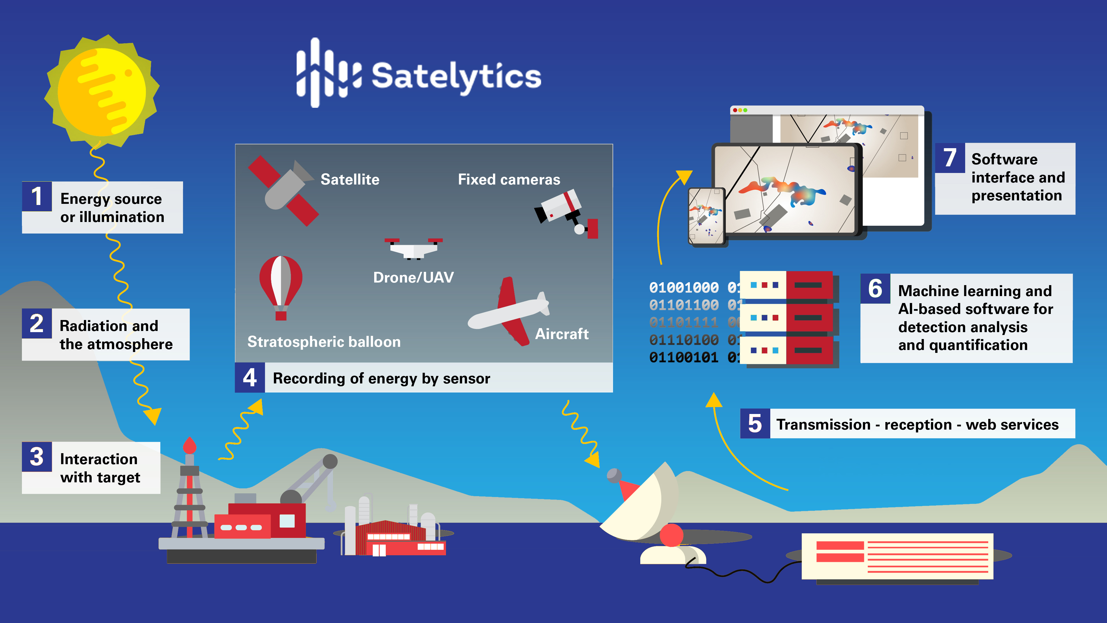
Satelytics - how it works.
Together, specific combinations of bands make up a spectral signature or “fingerprint” of an object or phenomena. Just like blood relatives often share similar yet distinct fingerprints, Satelytics can differentiate different species of trees and chemical and biological constituents using spectral signatures.
Satelytics analyzes petabytes of data — comprising thousands of individual aerial or satellite images — using algorithms we developed to isolate spectral signatures contained in the pixels of an image. All of our algorithms go through extensive testing and ground-truthing before they are added to our list of solutions. Additionally, each algorithm goes through a specific calibration process to be certified by the National Institute of Standards and Technology (NIST).
With our algorithms, our analysis process is automated through the employment of artificial intelligence and cloud computing. Through this analysis, the data is rendered into interactive displays, alerts, and visualizations.
Clients can then use our cloud-based platform, satelytics.io, to see data, compare locations over time, and continuously monitor infrastructure from anywhere. Customizable alert thresholds can be set to send alerts via SMS or to other web-enabled devices and software with a featureful API.
What separates Satelytics from all the pretenders out there? Science.
For more information about how science is our difference, see the Why Satelytics? tab on our website.
We use cookies to analyze our web traffic and to enhance your experience. By continuing to view this website, you agree to our use of cookies.
Our Privacy Policy