• General
• General
Data science is transforming industry as connectivity and cloud computing provide analysts with the power to optimize every corner of a company’s operation. Some of the most enthusiastic groups embracing Satelytics’ geospatial analytics are data scientists who want high-quality data, the newest data, and lots of it.
Let’s hit on each of these three data topics as they pertain to geospatial analytics and the available offerings.
Satelytics converts Big Data to actionable alerts in a heartbeat.
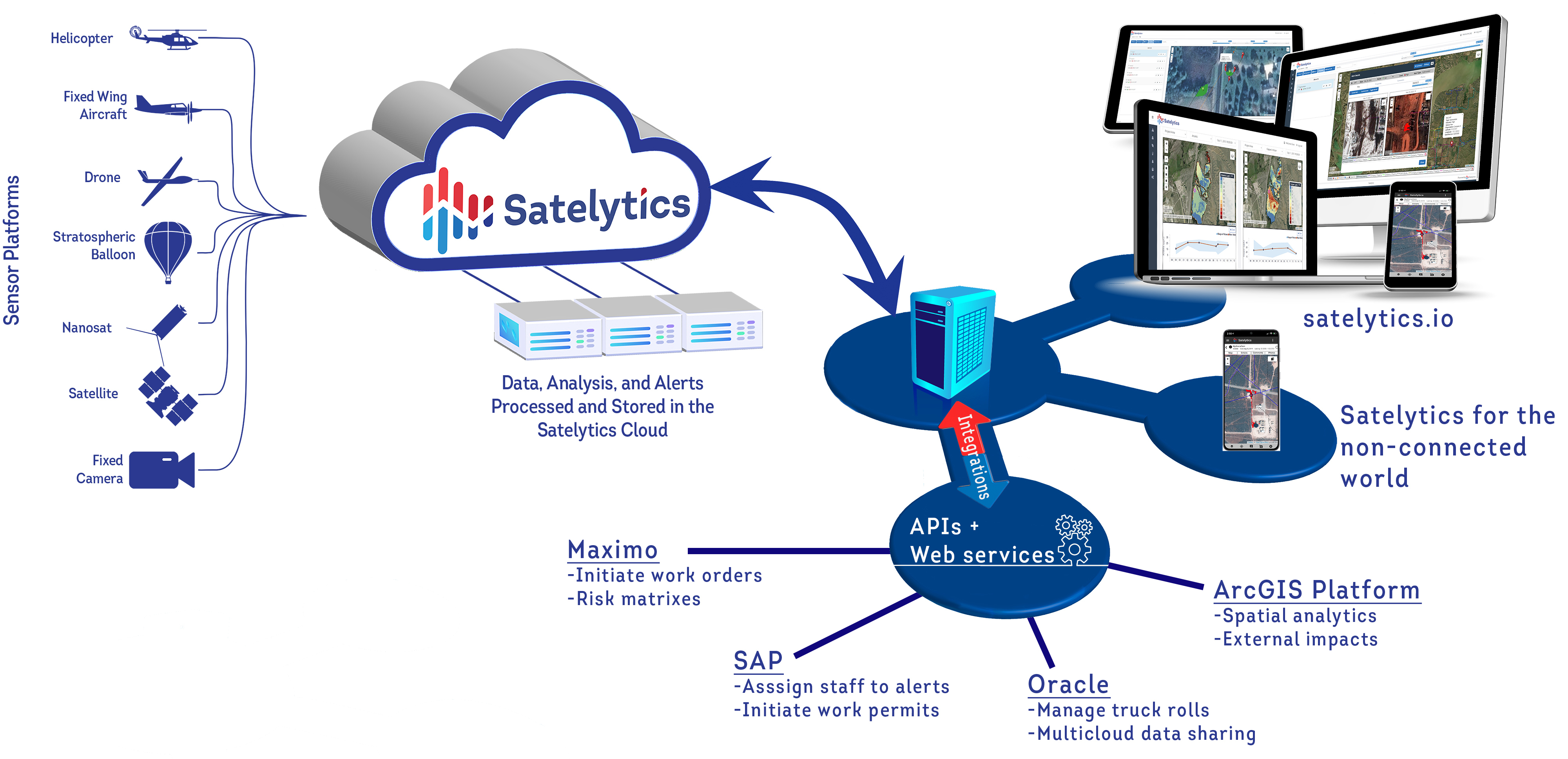
For one of our current customers, we recently tasked a satellite collect over their area of interest on a Saturday at noon. The data was gathered, QA/QC’d, preprocessed, and fed through the sausage machine. Results were posted to the cloud via the customer’s web portal… that afternoon! Unlike other methods you may have explored, we operate in the here and now because when an unwanted event strikes, you want to deal with it immediately before the consequences grow large.
Big Data
This term is thrown around a lot today, but it is appropriate for geospatial data sets. Our motto is “every pixel, every time.” When we survey 6,000 miles of right-of-way for a customer, that’s a lot of pixels and equates to 42 terabytes of data! With unlimited cloud computing capacity, we quickly reduce this to meaningful alerts for our customers.
Our data scientists have built the best machine learning algorithms in the geospatial business and the accuracy of these measurements continues to grow as they are fed more data. Satelytics’ 40+ algorithms have demonstrated 10% accuracy right out of the box but many of them are within a few percent. The more they do, the more they learn, especially when fed with ground verified feedback from our wonderful customers.
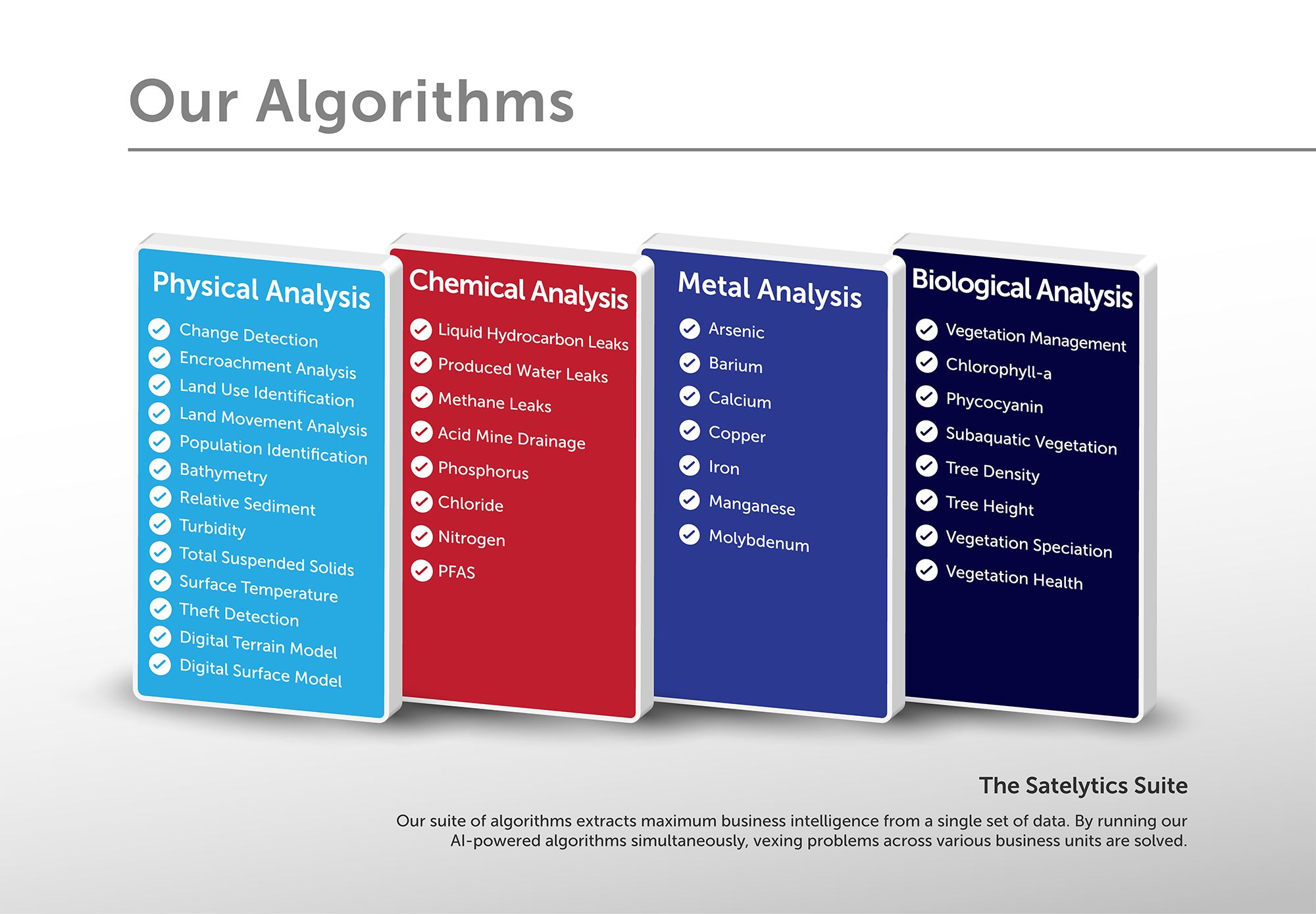
Satelytics' 40+ algorithms help you reduce risk and minimize consequences.
Investment in new observation platforms above the earth’s surface right now is staggering. It is predicted that satellite data will be available every few minutes anywhere on earth in a few short years. The data sources and volumes are multiplying rapidly.
Data scientists unite and compliment your company’s current data programs with geospatial data analytics!
We use cookies to analyze our web traffic and to enhance your experience. By continuing to view this website, you agree to our use of cookies.
Our Privacy Policy