At a Glance
- Ida has strengthened to a Category 1 hurricane in the Caribbean Sea.
- Ida is forecast to grow into a major hurricane in the Gulf of Mexico this weekend.
- Interests along the northern U.S. Gulf Coast should make hurricane preparations now.
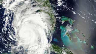
Ida has now become a Category 1 hurricane in the Caribbean Sea and is forecast to hammer the northern U.S. Gulf Coast as a major hurricane this weekend with life-threatening storm surge, dangerous rainfall flooding, potentially devastating winds and tornadoes.
Winds have ticked up to 75 mph according to Hurricane Hunters currently flying around inside Ida, making the storm a hurricane. This increase means that Ida is already rapidly intensifying since winds increased from 30 mph Thursday afternoon to 75 mph Friday afternoon, an increase of 35 mph in less than 24 hours.
Hurricane Ida has made landfall on the Isle of Youth.
Current Alerts
The National Hurricane Center has just upgraded parts of western Cuba to a hurricane warning, including the Isle of Youth and the provinces of Pinar del Rio and Artemisa.
A hurricane watch continues in effect from Cameron, Louisiana, to the Mississippi-Alabama state line, including the New Orleans metro area. Hurricane watches are typically issued 48 hours in advance of when tropical storm-force winds are expected to arrive since these conditions make it difficult to make preparations for a hurricane, once they begin.
A storm surge watch is also in effect from the Texas-Louisiana state line to the Alabama-Florida state line, including Vermilion Bay, Lake Borgne, Lake Pontchartrain, Lake Maurepas and Mobile Bay. This means dangerous flooding from storm surge is possible within the next 48 hours.
Finally, a tropical storm watch has been issued near the Alabama coast, where tropical storm conditions are possible within 48 hours.

Interests near the coast from Louisiana to Alabama should monitor Ida's progress closely and make hurricane preparations. The National Hurricane Center (NHC) says there is an increasing risk for hurricane-force winds, flooding rainfall and life-threatening storm surge Sunday and Monday, especially in Louisiana.
Current Status
Ida is located on the Isle of Youth, or just south of western portions of the Cuban mainland, moving northwest at 15 mph.
Bands of heavy rain continue to soak parts of Jamaica, the Cayman Islands and Cuba. Wind gusts as high as 55 mph have been reported in western Cuba in the last few hours.
Thunderstorms continue to erupt near Ida's center, typically a sign of a strengthening hurricane.
Ida became the ninth named storm of the 2021 Atlantic hurricane season late Thursday afternoon while located between Grand Cayman and Jamaica, based on measurements by a U.S. Air Force Reserve Hurricane Hunter mission.
(MORE MAPS: Spaghetti Models, Rainfall Outlooks, etc.)

Forecast Intensity, Track
The NHC is expected to level out in intensity or even intensify over western Cuba Friday night, which prompted the upgrade to hurricane warnings, there.
An area of high pressure over the Southeast U.S. will be the large-scale steering wheel for the system, with its clockwise circulation sending it northwestward toward a landfall somewhere along the Louisiana or Mississippi coast Sunday afternoon or evening.
Ida may undergo a period of rapid intensification as a hurricane when it tracks through the Gulf of Mexico this weekend. That's because Gulf of Mexico water temperatures are plenty warm, upper-level winds should be favorable and there's plenty of moist air available.
Therefore, Ida is currently expected to be at major hurricane strength, possibly even Category 4 intensity, when it approaches the northern Gulf Coast Sunday.
Ida could make landfall as a major hurricane on the 16th anniversary of Hurricane Katrina's landfalls in southeast Louisiana and Mississippi on Aug. 29, 2005.
Four named storms, including three hurricanes (Laura, Delta and Zeta), made landfall in Louisiana in 2020.
Forecast Impacts
Keep in mind that impacts will arrive before any landfall and that impacts could extend outside the forecast path shaded red in the map above.
Storm Surge
The NHC is forecasting water levels to rise to 4 to 6 feet above normal tides as Ida passes through western Cuba in areas where winds blow onshore.
Along the Gulf Coast, the following storm surge inundations are possible if the peak surge happens at high tide.
-Morgan City, Louisiana, to Ocean Springs, Mississippi, including Lake Borgne: 7 to 11 feet
-Rockefeller Wildlife Refuge, Louisiana, to Morgan City, Louisiana, including Vermilion Bay: 4 to 7 feet
-Ocean Springs, Mississippi, to the Mississippi-Alabama border: 4 to 7 feet
-Alabama coast including Mobile Bay: 3 to 5 feet
-Lake Pontchartrain: 4 to 6 feet
-Lake Maurepas: 3 to 5 feet
-Texas-Louisiana border to Rockefeller Wildlife Refuge, Louisiana: 2 to 4 feet
This peak surge will occur within an hour or two of Ida's landfall. However, some coastal flooding could also occur in areas of onshore flow as soon as early Sunday morning that may cut off escape routes from the coast.
The NHC also notes that overtopping of local levees outside of the Hurricane and Storm Damage Risk Reduction System is possible where local inundation values may be higher.

Winds
Tropical storm conditions could arrive along portions of the northern Gulf Coast as soon as late Saturday night, which will make hurricane preparations difficult.
The NHC said "potentially devastating wind damage could occur where the core of Ida moves onshore" Sunday.
Downed trees, widespread power outages and some structural damage are possible in the hurricane watch areas possibly as early as Saturday night and continuing into Sunday, including the New Orleans metro area.
At least tropical storm-force winds are expected to punch into inland parts of Louisiana and Mississippi into Monday.
(PERSPECTIVE: Beware the 'I' Storm)

Rainfall
Bands of heavy rainfall up to 20 inches could trigger dangerous flash flooding and landslides in Jamaica, the Cayman Islands and western Cuba through Friday.
NOAA's Weather Prediction Center is forecasting the following rainfall totals:
-Southeast Louisiana, coastal Mississippi and coastal Alabama: 8 to 16 inches with isolated 20-inch totals through Monday
-Rest of southern, central Mississippi: 4 to 8 inches
This will likely trigger widespread flash flooding, particularly where bands of rain stall for a period of a few hours. It will also lead to river flooding that could linger for several days after the storm.
At least a local flash flood threat will also penetrate inland into the Deep South and Tennessee Valley Monday and Tuesday.

High Surf, Rip Currents
High surf and rip currents will affect the northern Gulf Coast beginning Saturday night or early Sunday.
Tornadoes
Isolated tornadoes are frequently a concern with landfalling tropical cyclones.
Some rotating cells in Ida's rainbands may spawn tornadoes not only near coast as it heads toward land Sunday, but also inland over the South Monday into Tuesday.
As a reminder, Tropical Storm Fred spawned 29 tornadoes from the South to the Northeast over a week ago.
Forecast changes are likely over the next couple of days, so check back with us at weather.com for important forecast updates.
Now is a good time to ensure you have a hurricane plan in place in case this system becomes a growing threat where you live.
The Weather Company’s primary journalistic mission is to report on breaking weather news, the environment and the importance of science to our lives. This story does not necessarily represent the position of our parent company, IBM.


