A new report provides insight for improving access to education for all children in Sierra Leone
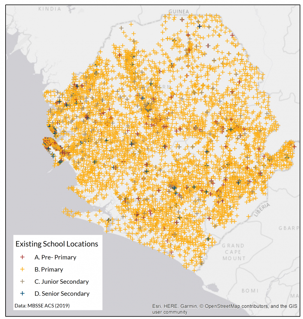
The Ministry of Basic and Senior Secondary Education (MBSSE) in Sierra Leone and GRID3 jointly released an Education Coverage in Sierra Leone report which identifies where children are located relative to schools based on a three-mile distance. Analyses from this report used data on existing school locations from the MBSSE 2019 Annual School Census, as well as GRID3 population estimates and settlement data.
“This report comes at a crucial time when we are embarking on school development. The findings demonstrate that while current national school coverage is high but more can be done. The collaboration with GRID3 will allow the government to continue its provision of educational resources to the people of Sierra Leone by informing future school plans,”
says David Sengeh, Minister of Basic and Senior Secondary Education and Chief Innovation Officer for the Government of Sierra Leone.
Putting together the report
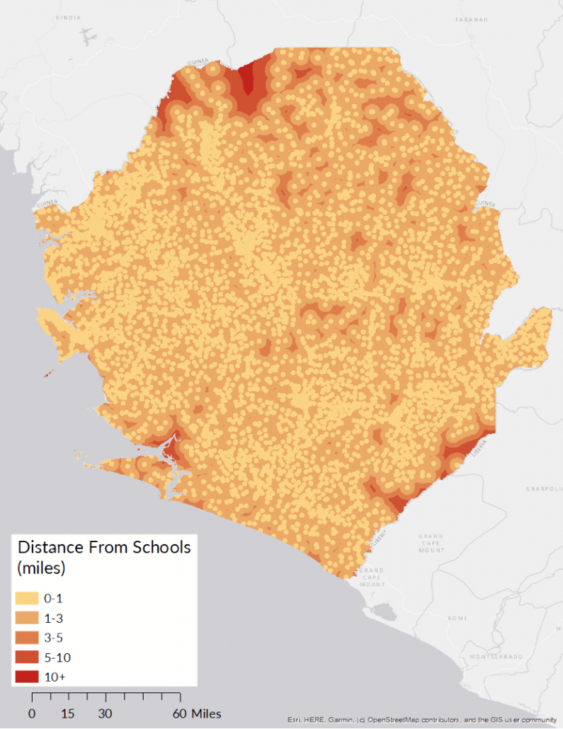
According to MBSSE’s pre-existing guidelines, children should be within 3 miles of a school in order to access educational resources. Using this target, GRID3 conducted a school coverage assessment with the GRID3 Sierra Leone population estimates, disaggregated by age. They compared the location of the population to the location of existing schools to determine straight-line home-school distance to understand current school coverage.
Findings revealed Primary schools have the highest coverage rate, where 99 percent of children ages 6-11 are within a three-mile distance of a school. Coverage rates for Pre-Primary (ages 3-5), Junior Secondary (ages 12-14), and Senior Secondary (ages 15-17) schools, however, are much lower (54 percent, 71 percent, and 53 percent, respectively). Distance is not the only metric for evaluating access to quality education though — other parameters include teacher-pupil ratio, transportation, and rate of enrolment across school levels which other partners in education will be exploring.
“Implementing a 3-mile distance as a school catchment area has not been completely feasible across the country especially in rural areas because too few live in these areas and other structural challenges like road, water, energy and connectivity issues remain,”
explains Sengeh.
“Additionally, in these remote areas, the terrain is not conducive for normal motor transportation such as buses. If we only focused on access, we would miss these and other important issues like teacher availability. It is critical that quality education service delivery be available for all.”
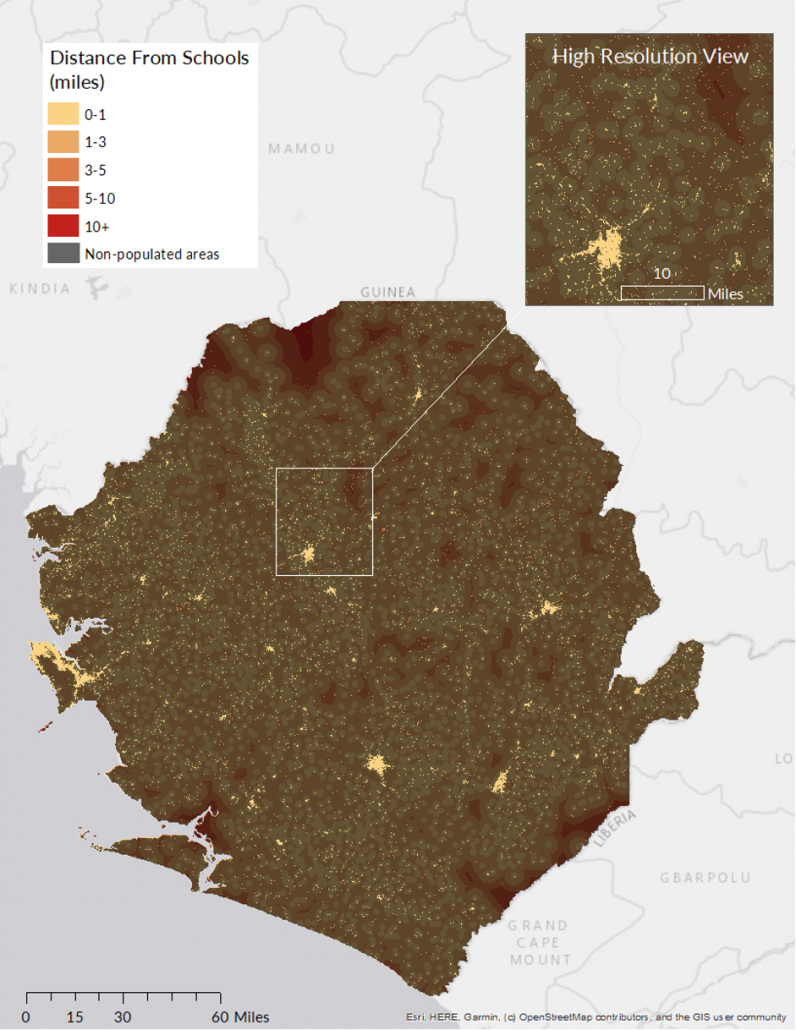
After the general analysis, GRID3 assessed school coverage using other factors such as ownership (private vs. public schools), quality, and the geographic location of the school (urban vs. rural). Government officials and GRID3 believe these additional factors will provide more insight into how to implement interventions that can increase access to high quality education in the country. To perform this assessment, both GRID3 population estimates and settlement extents were used.
For example, the School Coverage Assessment by School Type analysis revealed that primary schools had the highest coverage rate, with 98.51% of children aged 6-11 located within the 3-mile radius of a school. This coverage is achieved due to the high concentration and spread of primary school locations across the country. However, findings highlighted that coverage rates for pre-primary, junior secondary, and senior secondary were considerably lower (54%, 71%, and 53% respectively).
“When assessing the 3 mile coverage target, the majority of the population is within 3 miles of a school location (98.67%). However, when you break this down by school type and district, you can begin to see where there are gaps in coverage and which age-groups these affect the most,”
explains Alina Game, a GRID3 GIS expert who worked on the report.
As a next step, GRID3 will perform analyses to provide suggestions for new classroom locations using a site placement optimisation method developed by GRID3 partner Flowminder. The team will also engage key stakeholders to increase the use of the data. The results from this report and GRID3’s optimisation work will inform a nationwide strategy around the planning of suitable school catchment areas, placement of students for examinations, and construction of additional classrooms.
To read the full report, please click here.
